

Groß Gievitz topographic map
Click on the map to display elevation.
Groß Gievitz
Die Flagge von Groß Gievitz ist gleichmäßig längsgestreift von Blau und Gold (Gelb). In der Mitte des Flaggentuchs liegt, auf jeweils zwei Drittel der Höhe des blauen und goldenen (gelben) Streifens übergreifend, das Gemeindewappen. Die Höhe des Flaggentuchs verhält sich zur Länge wie 3:5.
About this map
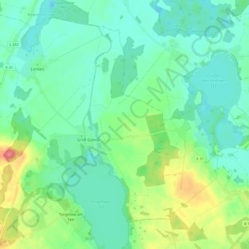
Name: Groß Gievitz topographic map, elevation, terrain.
Average elevation: 46 m
Minimum elevation: 25 m
Maximum elevation: 101 m
Other topographic maps
Click on a map to view its topography, its elevation and its terrain.
Ihlpohl
Deutschland > Mecklenburg-Vorpommern > Mecklenburgische Seenplatte > Peenehagen > Neu Schönau
Average elevation: 74 m

Levenstorf
Deutschland > Mecklenburg-Vorpommern > Mecklenburgische Seenplatte > Peenehagen
Average elevation: 73 m