
La Ceja topographic map
Interactive map
Click on the map to display elevation.
About this map
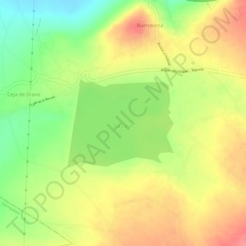
Name: La Ceja topographic map, elevation, terrain.
Location: La Ceja, Buenavista, Huimilpan, Querétaro, México (20.37311 -100.38543 20.38263 -100.37302)
Average elevation: 2,185 m
Minimum elevation: 2,138 m
Maximum elevation: 2,221 m