
Isla Clarión topographic map
Click on the map to display elevation.
Isla Clarión
As the topography of Clarion lacks any prominent peaks that could induce rains like Cerro Evermann on Socorro Island, the island is semiarid to arid all over. Consequently, the whole of the island is covered in shrubland, grassland and Opuntia cacti. Far away from land, endemic taxa are fewer than on Socorro but like there mainly consist of landbirds and plants. Rabbits and feral sheep are found on the island and have caused serious harm to the local vegetation; pigs introduced in 1979 have caused harm to the local fauna. Native vertebrates – except birds – are limited to two snake species and one iguanid lizard species, both endemic.
About this map
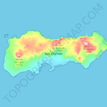
Name: Isla Clarión topographic map, elevation, terrain.
Location: Isla Clarión, Tecomán, Colima, Mexico (18.33916 -114.75975 18.37245 -114.68057)
Average elevation: 31 m
Minimum elevation: -3 m
Maximum elevation: 291 m