Geolocate

Bussoli topographic map

Click on the map to display elevation.

About this map

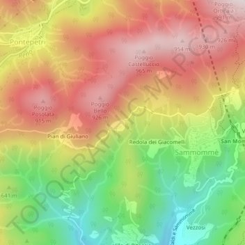
Name: Bussoli topographic map, elevation, terrain.

Location: Bussoli, Orsaia, Sammommè, Pistoia, Tuscany, Italy (44.01914 10.88720 44.03914 10.90720)

Average elevation: 659 m

Minimum elevation: 306 m

Maximum elevation: 973 m

Gear up for your next adventure:

🧭Orienteering Kit - Tools for map reading and navigation in the wild
🔋Solar Power Bank - Keep your GPS and devices charged during long outdoor trips
🥘Camping Cookware Set - Compact nesting pots and pans for trail cooking
🪑Insulated Seat Pad - Protect your seat from cold rocks and wet logs
🥾Trekking Poles - Adjustable trekking poles to reduce knee stress and improve stability

As an Amazon Associate, this site earns from qualifying purchases at no extra cost to you.