Geolocate

Stansfield topographic map

Click on the map to display elevation.

About this map

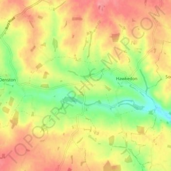
Name: Stansfield topographic map, elevation, terrain.

Location: Stansfield, West Suffolk, Suffolk, England, United Kingdom (52.12059 0.57754 52.16730 0.62002)

Average elevation: 91 m

Minimum elevation: 47 m

Maximum elevation: 126 m

Gear up for your next adventure:

🛶Kayak Accessories - Essential gear for safe and fun kayaking adventures
Camping Coffee Maker - Brew fresh coffee anywhere on the topographic map
🥾All-Terrain Hiking Boots - Versatile boots for varied hiking conditions
🧴Sunscreen SPF - Broad-spectrum sunscreen for outdoor activities
🥾Trekking Poles - Adjustable trekking poles to reduce knee stress and improve stability

As an Amazon Associate, this site earns from qualifying purchases at no extra cost to you.