Geolocate

Villa Martín topographic map

Click on the map to display elevation.

About this map
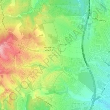
Name: Villa Martín topographic map, elevation, terrain.

Location: Villa Martín, Orihuela, La Vega Baja del Segura, Alicante, Comunidad Valenciana, 03189, España (37.92127 -0.77732 37.96127 -0.73732)

Average elevation: 74 m

Minimum elevation: 10 m

Maximum elevation: 161 m

Other topographic maps

Click on a map to view its topography, its elevation and its terrain.

Gear up for your next adventure:

🔭Compact Binoculars - Lightweight optics for scouting trails and wildlife
🥾Lightweight Hiking Shoes - Comfortable shoes for day hikes
🔭Outdoor Binoculars - Lightweight binoculars for birdwatching and hiking
🥾Hiking Leggings - Comfortable leggings for outdoor activities
🥾Hiking Shoes - Durable and comfortable shoes for trail hiking

As an Amazon Associate, this site earns from qualifying purchases at no extra cost to you.