Geolocate

Dierdorf topographic map

Click on the map to display elevation.

About this map
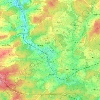
Name: Dierdorf topographic map, elevation, terrain.

Location: Dierdorf, Landkreis Neuwied, Rhineland-Palatinate, 56269, Germany (50.51883 7.58279 50.59464 7.70290)

Average elevation: 281 m

Minimum elevation: 206 m

Maximum elevation: 380 m

Other topographic maps

Click on a map to view its topography, its elevation and its terrain.
Gear up for your next adventure:

🎒Hiking Backpack - Lightweight and ergonomic backpacks for day hikes or multi-day treks
🧦Hiking Socks - Moisture-wicking and comfortable socks for long hikes
🥾Approach Boots - Comfortable boots for hiking and climbing approaches
🧥Softshell Jacket - Windproof and breathable jacket for hiking
🛁Quick-Dry Microfiber Towel - Space-saving towel that dries rapidly on the move

As an Amazon Associate, this site earns from qualifying purchases at no extra cost to you.