
Thank you for supporting this site ❤️
Make a donation
Make a donation
Gear up for your next adventure:
As an Amazon Associate, this site earns from qualifying purchases at no extra cost to you.
Čeče topographic map
Click on the map to display elevation.
Thank you for supporting this site ❤️
Make a donation
Make a donation
Gear up for your next adventure:
As an Amazon Associate, this site earns from qualifying purchases at no extra cost to you.
About this map
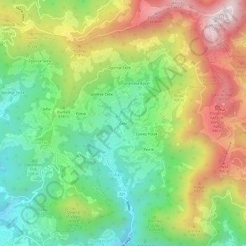
Name: Čeče topographic map, elevation, terrain.
Location: Čeče, Boben, Hrastnik, 1430, Slovenia (46.15094 15.06583 46.19094 15.10583)
Average elevation: 625 m
Minimum elevation: 294 m
Maximum elevation: 1,096 m
Thank you for supporting this site ❤️
Make a donation
Make a donation
Gear up for your next adventure:
As an Amazon Associate, this site earns from qualifying purchases at no extra cost to you.