
Thank you for supporting this site ❤️
Make a donation
Make a donation
Gear up for your next adventure:
As an Amazon Associate, this site earns from qualifying purchases at no extra cost to you.
Signalkuppe topographic map
Click on the map to display elevation.
Thank you for supporting this site ❤️
Make a donation
Make a donation
Gear up for your next adventure:
As an Amazon Associate, this site earns from qualifying purchases at no extra cost to you.
About this map
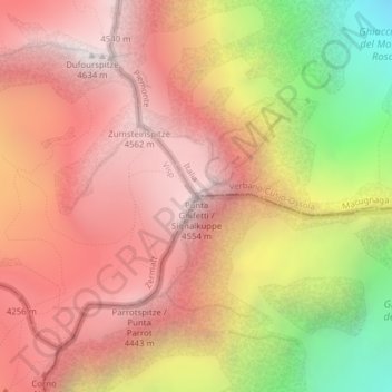
Name: Signalkuppe topographic map, elevation, terrain.
Location: Signalkuppe, Macugnaga, Verbano-Cusio-Ossola, Piemont, Italien (45.92716 7.87703 45.92726 7.87713)
Average elevation: 3,872 m
Minimum elevation: 2,648 m
Maximum elevation: 4,619 m
Thank you for supporting this site ❤️
Make a donation
Make a donation
Gear up for your next adventure:
As an Amazon Associate, this site earns from qualifying purchases at no extra cost to you.