Geolocate

Castlepoint topographic map

Click on the map to display elevation.

About this map

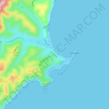
Name: Castlepoint topographic map, elevation, terrain.

Location: Castlepoint, Masterton, Wellington, New Zealand (-40.92088 176.20172 -40.88088 176.24172)

Average elevation: 29 m

Minimum elevation: -4 m

Maximum elevation: 212 m

Gear up for your next adventure:

🥾Trail Hiking Socks - Comfortable socks to prevent blisters and fatigue
🛶Waterproof Dry Bags - Keep electronics and clothes dry during river crossings
🧊Portable Cooler - Keep food and drinks cold during outdoor adventures
🧥Softshell Jacket - Windproof and breathable jacket for hiking
🔦UV Flashlight - Detect minerals or specific insects in the dark

As an Amazon Associate, this site earns from qualifying purchases at no extra cost to you.