Geolocate

Ocaña topographic map

Click on the map to display elevation.

About this map
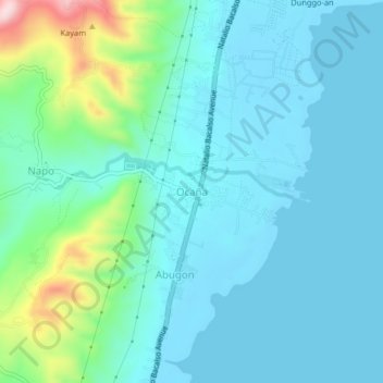
Name: Ocaña topographic map, elevation, terrain.

Location: Ocaña, Carcar, Cebu, Central Visayas, 6019, Philippines (10.04606 123.60730 10.08606 123.64730)

Average elevation: 53 m

Minimum elevation: -2 m

Maximum elevation: 299 m

Gear up for your next adventure:

☕Camping Coffee Maker - Brew fresh coffee anywhere on the topographic map
🧭GPS Handheld Device - Reliable GPS navigation for outdoor adventures
🚲Heavy Duty Bike Lock - Secure your bike at the trailhead or during stops
🔦LED Headtorch - Bright and durable light for night activities
⛺Lightweight Backpacking Tent - Compact tent for efficient hiking trips

As an Amazon Associate, this site earns from qualifying purchases at no extra cost to you.