Geolocate

Chorrera topographic map

Click on the map to display elevation.

About this map

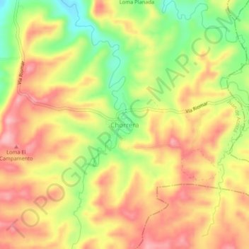
Name: Chorrera topographic map, elevation, terrain.

Location: Chorrera, Juan de Acosta, Atlántico, Colombia (10.77958 -75.03115 10.81958 -74.99115)

Average elevation: 150 m

Minimum elevation: 63 m

Maximum elevation: 215 m

Other topographic maps

Click on a map to view its topography, its elevation and its terrain.

Saco

Colombia > Atlántico > Juan de Acosta

Average elevation: 80 m

Saco

Colombia > Atlántico > Juan de Acosta

Average elevation: 80 m

Gear up for your next adventure:

💡Compact LED Flashlight - Powerful and portable flashlight for outdoor use
🧴Outdoor Sunscreen - High SPF protection for high-altitude UV exposure
🧼Travel Hand Sanitizer - Keep hands clean when water is scarce
🔋Lithium AA Batteries - Long-lasting power that performs in extreme cold
🥾Waterproof Hiking Boots - Boots keeping your feet dry in wet conditions

As an Amazon Associate, this site earns from qualifying purchases at no extra cost to you.