Geolocate

Cardama topographic map

Click on the map to display elevation.

About this map

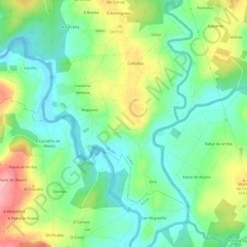
Name: Cardama topographic map, elevation, terrain.

Location: Cardama, Oroso, Ordes, La Coruña, Galicia, España (42.95449 -8.40108 42.98216 -8.34482)

Average elevation: 279 m

Minimum elevation: 232 m

Maximum elevation: 363 m

Gear up for your next adventure:

🚲MTB Frame Bag - Carry tools and maps directly on your bicycle frame
💡Portable Camping Lamp - Rechargeable lamp for campsite lighting
🥾Hiking Gaiters - Protect legs and shoes from mud, snow, and debris
🕯️Camping Lantern - Illuminates your entire campsite with high-efficiency LEDs
🧤Rechargeable Heated Gloves - Extreme warmth for Canadian winter expeditions

As an Amazon Associate, this site earns from qualifying purchases at no extra cost to you.