
Tawain topographic map
Interactive map
Click on the map to display elevation.
About this map
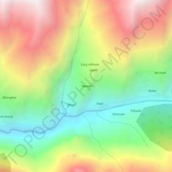
Name: Tawain topographic map, elevation, terrain.
Location: Tawain, Pangi, Chamba district, Himachal Pradesh, Inde (32.96707 76.48334 33.00707 76.52334)
Average elevation: 3,154 m
Minimum elevation: 2,421 m
Maximum elevation: 4,051 m
Other topographic maps
Click on a map to view its topography, its elevation and its terrain.