Geolocate

White Peak topographic map

Click on the map to display elevation.

About this map

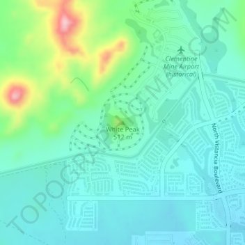
Name: White Peak topographic map, elevation, terrain.

Location: White Peak, Peoria, Maricopa County, Arizona, United States (33.77221 -112.35244 33.77231 -112.35234)

Average elevation: 480 m

Minimum elevation: 440 m

Maximum elevation: 619 m

Other topographic maps

Click on a map to view its topography, its elevation and its terrain.

Sun City

United States > Arizona > Maricopa County > Peoria

Average elevation: 356 m

Sun City

United States > Arizona > Maricopa County > Peoria

Average elevation: 356 m

Gear up for your next adventure:

🧢Outdoor Cap - Protective cap for sun and rain during hikes
🏕️Camping Hammock - Integrated protection for sleeping between trees
💧Collapsible Water Bottle - Space-saving water bottle for outdoor activities
🥾Durable Hiking Shoes - Long-lasting shoes for frequent hiking
🏃Hydration Running Vest - Carry water and maps close to your body for speed

As an Amazon Associate, this site earns from qualifying purchases at no extra cost to you.