
Make a donation
Gear up for your next adventure:
As an Amazon Associate, this site earns from qualifying purchases at no extra cost to you.
Netrang topographic map
Click on the map to display elevation.
Make a donation
Gear up for your next adventure:
As an Amazon Associate, this site earns from qualifying purchases at no extra cost to you.
Netrang
Netrang lies in the southern part of the Gujarat peninsula at an elevation of 435 metres (1,427 ft) and has a tropical savanna climate (under Köppen's Climate classification), moderated by the Arabian Sea. The summer begins in early March and lasts until June. April and May are the hottest months, the average maximum temperature being 43 °C (109 °F). The monsoon season begins in late June and the town receives about 800 millimetres (31 in) of rain by the end of September, with the average maximum temperature being 32 °C (90 °F) during those months. October and November see the retreat of the monsoon and a return of high temperatures until late November. Winter starts in December and ends in late February, with average temperatures of around 23 °C (73 °F).
Make a donation
Gear up for your next adventure:
As an Amazon Associate, this site earns from qualifying purchases at no extra cost to you.
About this map
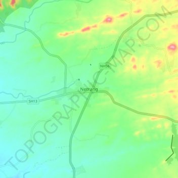
Name: Netrang topographic map, elevation, terrain.
Average elevation: 131 m
Minimum elevation: 91 m
Maximum elevation: 229 m
Make a donation
Gear up for your next adventure:
As an Amazon Associate, this site earns from qualifying purchases at no extra cost to you.