
Thank you for supporting this site ❤️
Make a donation
Make a donation
Gear up for your next adventure:
As an Amazon Associate, this site earns from qualifying purchases at no extra cost to you.
Accident topographic map
Click on the map to display elevation.
Thank you for supporting this site ❤️
Make a donation
Make a donation
Gear up for your next adventure:
As an Amazon Associate, this site earns from qualifying purchases at no extra cost to you.
About this map
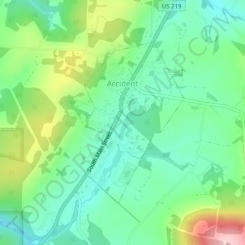
Name: Accident topographic map, elevation, terrain.
Location: Accident, Garrett County, Maryland, United States (39.61571 -79.32631 39.63354 -79.31200)
Average elevation: 751 m
Minimum elevation: 685 m
Maximum elevation: 894 m
Thank you for supporting this site ❤️
Make a donation
Make a donation
Gear up for your next adventure:
As an Amazon Associate, this site earns from qualifying purchases at no extra cost to you.
Other topographic maps
Click on a map to view its topography, its elevation and its terrain.
Casselman Bridge State Park
United States > Maryland > Garrett County > Grantsville
Average elevation: 696 m