
Thank you for supporting this site ❤️
Make a donation
Make a donation
Gear up for your next adventure:
As an Amazon Associate, this site earns from qualifying purchases at no extra cost to you.
Combapata topographic map
Click on the map to display elevation.
Thank you for supporting this site ❤️
Make a donation
Make a donation
Gear up for your next adventure:
As an Amazon Associate, this site earns from qualifying purchases at no extra cost to you.
About this map
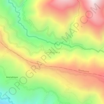
Name: Combapata topographic map, elevation, terrain.
Location: Combapata, Quelloúno, La Convención, Cusco, Perú (-12.66600 -72.32596 -12.62600 -72.28596)
Average elevation: 1,619 m
Minimum elevation: 961 m
Maximum elevation: 2,280 m
Thank you for supporting this site ❤️
Make a donation
Make a donation
Gear up for your next adventure:
As an Amazon Associate, this site earns from qualifying purchases at no extra cost to you.