Geolocate

Bani topographic map

Click on the map to display elevation.

About this map

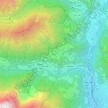
Name: Bani topographic map, elevation, terrain.

Location: Bani, Rizzoli, Ardesio, Bergamo, Lombardy, 24020, Italy (45.93306 9.88539 45.97306 9.92539)

Average elevation: 1,064 m

Minimum elevation: 544 m

Maximum elevation: 2,194 m

Gear up for your next adventure:

🧴Sunscreen SPF - Broad-spectrum sunscreen for outdoor activities
🧥Thermal Fleece Jacket - Versatile insulation for changing mountain temperatures
🚲Handlebar Phone Mount - View topographic-map.com live while cycling
🥘Camping Cookware Set - Compact nesting pots and pans for trail cooking
🧥Fleece Jacket - Warm and lightweight jacket for layering

As an Amazon Associate, this site earns from qualifying purchases at no extra cost to you.