
Make a donation
Gear up for your next adventure:
As an Amazon Associate, this site earns from qualifying purchases at no extra cost to you.
Ait Ayach topographic map
Click on the map to display elevation.
Make a donation
Gear up for your next adventure:
As an Amazon Associate, this site earns from qualifying purchases at no extra cost to you.
Ait Ayach
Aït Ayach est située à vol d'oiseau à environ 18 km de Midelt (chef-lieu de sa province) et 157 km de Meknès (chef-lieu de sa région). Son altitude est de 1 516 m.
Make a donation
Gear up for your next adventure:
As an Amazon Associate, this site earns from qualifying purchases at no extra cost to you.
About this map
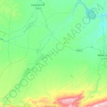
Name: Ait Ayach topographic map, elevation, terrain.
Average elevation: 1,627 m
Minimum elevation: 1,229 m
Maximum elevation: 2,988 m
Make a donation
Gear up for your next adventure:
As an Amazon Associate, this site earns from qualifying purchases at no extra cost to you.
Other topographic maps
Click on a map to view its topography, its elevation and its terrain.