Geolocate

POROPOT topographic map

Click on the map to display elevation.

About this map

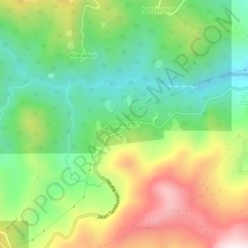
Name: POROPOT topographic map, elevation, terrain.

Location: POROPOT, Sabah, Malaysia (5.87397 116.58247 5.91397 116.62247)

Average elevation: 748 m

Minimum elevation: 457 m

Maximum elevation: 1,195 m

Other topographic maps

Click on a map to view its topography, its elevation and its terrain.

Mabul Island

Malaysia > Sabah

Average elevation: 0 m

Gear up for your next adventure:

🥤Collapsible Travel Cup - Saves space and weight in your mess kit
🥾Hiking Boots - Sturdy boots providing ankle support and traction on rugged trails
🥾Hiking Shorts - Breathable shorts suitable for summer hikes
🥾All-Terrain Hiking Boots - Versatile boots for varied hiking conditions
🧭GPS Handheld Device - Reliable GPS navigation for outdoor adventures

As an Amazon Associate, this site earns from qualifying purchases at no extra cost to you.