Geolocate

Bridgeport topographic map

Click on the map to display elevation.

About this map

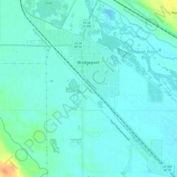
Name: Bridgeport topographic map, elevation, terrain.

Location: Bridgeport, Morrill County, Nebraska, 69336, United States (41.64121 -103.11589 41.68046 -103.07203)

Average elevation: 1,119 m

Minimum elevation: 1,111 m

Maximum elevation: 1,156 m

Other topographic maps

Click on a map to view its topography, its elevation and its terrain.

Chimney Rock

United States > Nebraska > Morrill County

Average elevation: 1,189 m

Gear up for your next adventure:

Camping Groundsheet - Protect your tent from moisture and dirt
🧢Hiking Sun Hat - Wide-brimmed protection for exposed mountain ridges
🥾Hiking Shorts - Breathable shorts suitable for summer hikes
💧Collapsible Water Bottle - Space-saving water bottle for outdoor activities
🥫Freeze-Dried Meals - Lightweight, high-calorie nutrition for multi-day treks

As an Amazon Associate, this site earns from qualifying purchases at no extra cost to you.