
Make a donation
Gear up for your next adventure:
As an Amazon Associate, this site earns from qualifying purchases at no extra cost to you.
Mooskopf topographic map
Click on the map to display elevation.
Make a donation
Gear up for your next adventure:
As an Amazon Associate, this site earns from qualifying purchases at no extra cost to you.
About this map
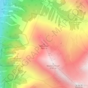
Name: Mooskopf topographic map, elevation, terrain.
Location: Mooskopf, Kaunertal, Bezirk Landeck, Tirol, 6524, Österreich (47.01354 10.76473 47.01364 10.76483)
Average elevation: 2,139 m
Minimum elevation: 1,295 m
Maximum elevation: 2,791 m
Make a donation
Gear up for your next adventure:
As an Amazon Associate, this site earns from qualifying purchases at no extra cost to you.
Other topographic maps
Click on a map to view its topography, its elevation and its terrain.
Gepatschferner
Österreich > Tirol > Bezirk Landeck > Kaunertal
Der Gepatschferner liegt südlich oberhalb des Kaunertals in Tirol in den Ötztaler Alpen, ca. 1500 Höhenmeter über dem Talschluss. Sein Nährgebiet wird eingegrenzt im Nordwesten von der 3526 Meter hohen Weißseespitze und im Südosten von den drei Hintereisspitzen (ca. 3450 m). Dazwischen verlaufen die…
Average elevation: 2,948 m
Kaunertal
Österreich > Tirol > Bezirk Landeck > Kaunertal
Die Skigebiete Kaunertaler Gletscher und Winterberg Fendels sind zu einer Skiregion mit 61 km Pisten zusammengeschlossen. Das Gebiet Kaunertaler Gletscher umfasst 50 km Piste und 8 Lifte, das Gebiet Winterberg Fendels bietet 11 km Piste und 6 Lifte. Das Gebiet Kaunertaler Gletscher, auf dem allerdings durch…
Average elevation: 2,257 m