Geolocate

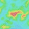
L'Approuague topographic map

Click on the map to display elevation.

About this map

Name: L'Approuague topographic map, elevation, terrain.

Location: L'Approuague, Régina, Saint-Georges, Guyane, France (4.40259 -51.95310 4.52908 -51.94089)

Average elevation: 4 m

Minimum elevation: -6 m

Maximum elevation: 105 m

Other topographic maps

Click on a map to view its topography, its elevation and its terrain.

La Nuit

France > Guyane > Régina

Average elevation: 292 m

Montagne Cariacou

France > Guyane > Régina

Average elevation: 46 m

Chutes Patawa

France > Guyane > Régina

Average elevation: 208 m

Zone agricole de Corossoni

France > Guyane > Régina

Average elevation: 33 m

La Nuit

France > Guyane > Régina

Average elevation: 292 m

Gear up for your next adventure:

🧊Insulated Water Bottle - Keeps drinks cold in summer and prevents freezing in winter
🥾All-Terrain Hiking Boots - Versatile boots for varied hiking conditions
🥾Trekking Poles - Adjustable trekking poles to reduce knee stress and improve stability
⛺Lightweight Backpacking Tent - Compact tent for efficient hiking trips
🛰️Satellite Messenger - Emergency communication for areas with no cell service

As an Amazon Associate, this site earns from qualifying purchases at no extra cost to you.