
Riverton topographic map
Click on the map to display elevation.
About this map
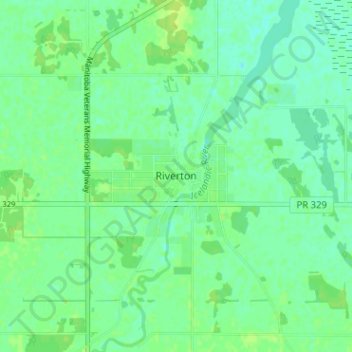
Name: Riverton topographic map, elevation, terrain.
Average elevation: 221 m
Minimum elevation: 215 m
Maximum elevation: 226 m
Division No. 18 trails, hiking, mountain biking, running and outdoor activities
Other topographic maps
Click on a map to view its topography, its elevation and its terrain.
Icelandic River
Canada > Manitoba > Division No. 18 > Rural Municipality of Bifrost – Riverton
Average elevation: 233 m