Geolocate

Bagi topographic map

Click on the map to display elevation.

About this map

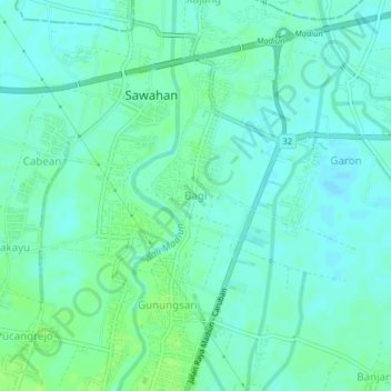
Name: Bagi topographic map, elevation, terrain.

Location: Bagi, Madiun, East Java, Java, 63125, Indonesia (-7.58264 111.52261 -7.54264 111.56261)

Average elevation: 54 m

Minimum elevation: 49 m

Maximum elevation: 59 m

Gear up for your next adventure:

💧Reusable Water Bottle - Durable water bottles for hydration on trails
🧴Bear Spray Holster - Quick-access carry for essential Canadian wilderness safety
👟Sport Hiking Sandals - Breathable footwear for water crossings and camp rest
🥾Lightweight Hiking Boots - Boots for comfort and mobility on long hikes
🧣Merino Neck Gaiter - Protects against wind, sun, and cold at high altitudes

As an Amazon Associate, this site earns from qualifying purchases at no extra cost to you.