
Baardheere بااردىرآ topographic map
Interactive map
Click on the map to display elevation.
About this map
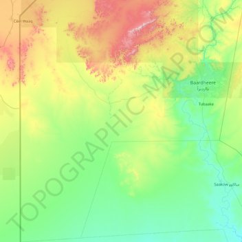
Name: Baardheere بااردىرآ topographic map, elevation, terrain.
Location: Baardheere بااردىرآ, Gedo, Jubaland, Somalia (1.23078 40.99037 2.94000 42.54171)
Average elevation: 222 m
Minimum elevation: 48 m
Maximum elevation: 855 m
Other topographic maps
Click on a map to view its topography, its elevation and its terrain.
Bardera
Somalia > Gedo > Baardheere بااردىرآ
Bardera, Baardheere بااردىرآ, Gedo, Jubaland, Somalia
Average elevation: 140 m