Geolocate

Duxeralm topographic map

Click on the map to display elevation.

About this map

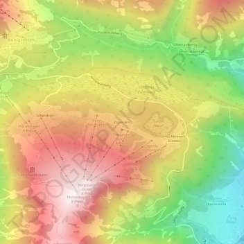
Name: Duxeralm topographic map, elevation, terrain.

Location: Duxeralm, Krimml, Bezirk Zell am See, Salzburg, 5743, Austria (47.21572 12.12496 47.25572 12.16496)

Average elevation: 1,563 m

Minimum elevation: 1,033 m

Maximum elevation: 2,031 m

Gear up for your next adventure:

🥾Approach Shoes - Shoes designed for climbing approaches and rugged trails
🧥Ultralight Puffy Jacket - Maximum warmth that packs down to the size of an orange
🧰Multitool Knife - Compact and versatile tool for outdoor use
🧭GPS Tracker - Track your location in remote areas safely
🔭Compact Binoculars - Lightweight optics for scouting trails and wildlife

As an Amazon Associate, this site earns from qualifying purchases at no extra cost to you.