
Thank you for supporting this site ❤️
Make a donation
Make a donation
Gear up for your next adventure:
As an Amazon Associate, this site earns from qualifying purchases at no extra cost to you.
Bressan topographic map
Click on the map to display elevation.
Thank you for supporting this site ❤️
Make a donation
Make a donation
Gear up for your next adventure:
As an Amazon Associate, this site earns from qualifying purchases at no extra cost to you.
About this map
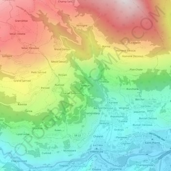
Name: Bressan topographic map, elevation, terrain.
Location: Bressan, Saint-Pierre, Valle d'Aosta, 11018, Italië (45.70128 7.18983 45.74128 7.22983)
Average elevation: 1,221 m
Minimum elevation: 622 m
Maximum elevation: 2,094 m
Thank you for supporting this site ❤️
Make a donation
Make a donation
Gear up for your next adventure:
As an Amazon Associate, this site earns from qualifying purchases at no extra cost to you.