Geolocate

大湾社区 topographic map

Click on the map to display elevation.

About this map

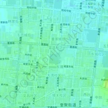
Name: 大湾社区 topographic map, elevation, terrain.

Location: 大湾社区, Kuiju, Changyi City, Weifang, Shandong, 261300, China (36.85235 119.38790 36.86403 119.41014)

Average elevation: 11 m

Minimum elevation: 7 m

Maximum elevation: 19 m

Gear up for your next adventure:

🥘Camping Cookware Set - Compact nesting pots and pans for trail cooking
🪜Heavy Duty Carabiners - Multi-use clips for securing gear to your backpack
🧥Waterproof Hiking Jacket - Protect yourself from rain and wind while hiking
📷Outdoor Action Camera - Capture high-elevation views and rugged adventures
🥾Trail Hiking Shoes - Durable shoes designed for rugged trails

As an Amazon Associate, this site earns from qualifying purchases at no extra cost to you.