Geolocate

Port O'Connor topographic map

Click on the map to display elevation.

About this map

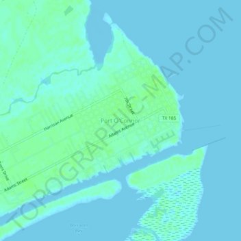
Name: Port O'Connor topographic map, elevation, terrain.

Location: Port O'Connor, Calhoun County, Texas, 97982, USA (28.42648 -96.43411 28.46648 -96.39411)

Average elevation: 3 m

Minimum elevation: -2 m

Maximum elevation: 8 m

Gear up for your next adventure:

👖Convertible Hiking Pants - Zip-off legs to adapt to changing weather conditions
🛌Insulated Sleeping Pad - Critical thermal barrier between you and the cold ground
Camping Tent - Weather-resistant tents suitable for 2 to 6 people
🥽Outdoor Goggles - Protective eyewear for outdoor activities
🥾Lightweight Hiking Boots - Boots for comfort and mobility on long hikes

As an Amazon Associate, this site earns from qualifying purchases at no extra cost to you.