
Thank you for supporting this site ❤️
Make a donation
Make a donation
Gear up for your next adventure:
As an Amazon Associate, this site earns from qualifying purchases at no extra cost to you.
Malvela topographic map
Click on the map to display elevation.
Thank you for supporting this site ❤️
Make a donation
Make a donation
Gear up for your next adventure:
As an Amazon Associate, this site earns from qualifying purchases at no extra cost to you.
About this map
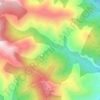
Name: Malvela topographic map, elevation, terrain.
Location: Malvela, Rubiá, Valdeorras, Ourense, Galiza, 32312, Espanha (42.47483 -6.95370 42.49483 -6.93370)
Average elevation: 882 m
Minimum elevation: 570 m
Maximum elevation: 1,175 m
Thank you for supporting this site ❤️
Make a donation
Make a donation
Gear up for your next adventure:
As an Amazon Associate, this site earns from qualifying purchases at no extra cost to you.