Geolocate

Mokena topographic map

Click on the map to display elevation.

About this map

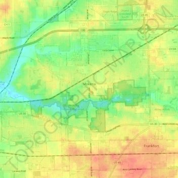
Name: Mokena topographic map, elevation, terrain.

Location: Mokena, Will County, Illinois, 60448, United States (41.49169 -87.92805 41.55556 -87.81190)

Average elevation: 218 m

Minimum elevation: 192 m

Maximum elevation: 243 m

Other topographic maps

Click on a map to view its topography, its elevation and its terrain.

Drummond

United States > Illinois > Will County

Average elevation: 167 m

Puddle Pond

United States > Illinois > Will County > Plainfield

Average elevation: 187 m

Arbury Hills

United States > Illinois > Will County

Average elevation: 216 m

Gear up for your next adventure:

🧴Insect Repellent - Protect yourself from bugs during outdoor adventures
🧼Biodegradable Camp Soap - Environmentally friendly cleaning for gear and body
🧦Crew Hiking Socks - Comfortable socks for long-distance hikes
🧢Hiking Sun Hat - Wide-brimmed protection for exposed mountain ridges
🥾Trail Hiking Shoes - Durable shoes designed for rugged trails

As an Amazon Associate, this site earns from qualifying purchases at no extra cost to you.