Geolocate

Yarmugam topographic map

Click on the map to display elevation.

About this map

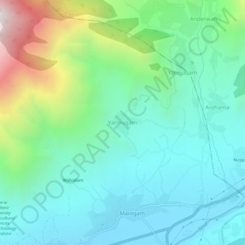
Name: Yarmugam topographic map, elevation, terrain.

Location: Yarmugam, Lar, Ganderbal District, Jammu and Kashmir, India (34.27600 74.77847 34.31600 74.81847)

Average elevation: 2,065 m

Minimum elevation: 1,653 m

Maximum elevation: 3,325 m

Gear up for your next adventure:

🥾Trail Hiking Socks - Comfortable socks to prevent blisters and fatigue
🧢Beanie Hat - Keep your head warm in cold weather
🧴Insect Repellent - Protect yourself from bugs during outdoor adventures
🥾Trail Hiking Shoes - Durable shoes designed for rugged trails
🥾Lightweight Hiking Boots - Boots for comfort and mobility on long hikes

As an Amazon Associate, this site earns from qualifying purchases at no extra cost to you.