Geolocate

Huajiang topographic map

Click on the map to display elevation.

About this map

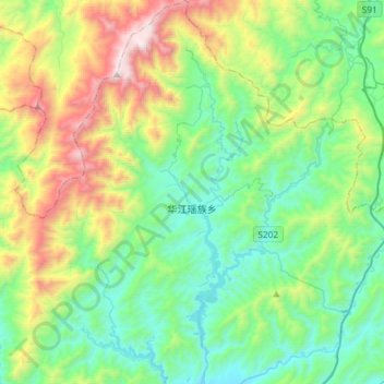
Name: Huajiang topographic map, elevation, terrain.

Location: Huajiang, Xing'an County, Guilin, Guangxi, China (25.65279 110.34003 25.91704 110.60293)

Average elevation: 727 m

Minimum elevation: 202 m

Maximum elevation: 2,093 m

Gear up for your next adventure:

🥾Mountain Hiking Boots - High-traction boots for rocky terrain
🥾Waterproof Hiking Boots - Boots keeping your feet dry in wet conditions
🛌Insulated Sleeping Pad - Critical thermal barrier between you and the cold ground
👟Leg Gaiters - Keep debris, mud, and snow out of your boots
🔦LED Headtorch - Bright and durable light for night activities

As an Amazon Associate, this site earns from qualifying purchases at no extra cost to you.