Geolocate

Midlothian topographic map

Click on the map to display elevation.

About this map

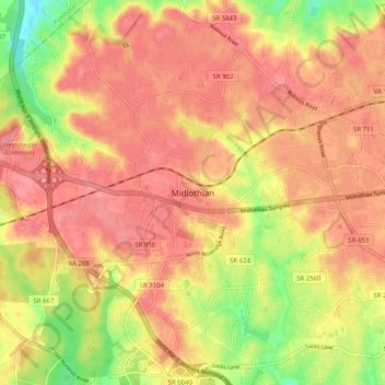
Name: Midlothian topographic map, elevation, terrain.

Location: Midlothian, Chesterfield County, Virginia, 23113, USA (37.46627 -77.68927 37.54627 -77.60927)

Average elevation: 97 m

Minimum elevation: 45 m

Maximum elevation: 123 m

Gear up for your next adventure:

🧦Crew Hiking Socks - Comfortable socks for long-distance hikes
🍽️Titanium Camping Spork - Ultralight and indestructible eating utensil
🧊Portable Cooler - Keep food and drinks cold during outdoor adventures
🧤Insulated Winter Gloves - Heavy-duty protection for sub-zero Canadian adventures
💡LED Headlamp - Hands-free illumination for night hiking and camping

As an Amazon Associate, this site earns from qualifying purchases at no extra cost to you.