
Den Ilp topographic map
Interactive map
Click on the map to display elevation.
About this map
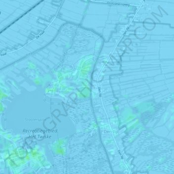
Name: Den Ilp topographic map, elevation, terrain.
Location: Den Ilp, Landsmeer, Nordholland, Niederlande (52.44424 4.89303 52.47195 4.91954)
Average elevation: -1 m
Minimum elevation: -7 m
Maximum elevation: 7 m
Other topographic maps
Click on a map to view its topography, its elevation and its terrain.
Landsmeer
Niederlande > Nordholland > Landsmeer
Landsmeer, Nordholland, Niederlande
Average elevation: -1 m
Purmerland
Niederlande > Nordholland > Landsmeer
Purmerland, Landsmeer, Nordholland, Niederlande
Average elevation: -2 m