
Rodoretto topographic map
Interactive map
Click on the map to display elevation.
About this map
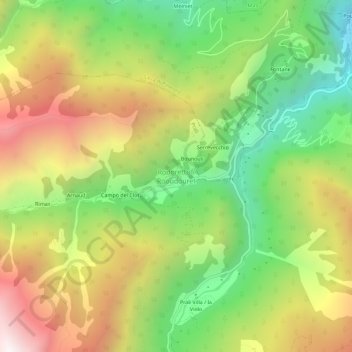
Name: Rodoretto topographic map, elevation, terrain.
Location: Rodoretto, Prali, Torino, Piemonte, Italia (44.89924 7.03252 44.93924 7.07252)
Average elevation: 1,658 m
Minimum elevation: 1,006 m
Maximum elevation: 2,452 m
Other topographic maps
Click on a map to view its topography, its elevation and its terrain.