Geolocate

Sondri topographic map

Click on the map to display elevation.

About this map

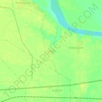
Name: Sondri topographic map, elevation, terrain.

Location: Sondri, Brahmapuri Taluka, Chandrapur, Maharashtra, India (20.61112 79.88989 20.65112 79.92989)

Average elevation: 222 m

Minimum elevation: 210 m

Maximum elevation: 227 m

Gear up for your next adventure:

🥾Light Trekking Boots - Supportive boots for multi-day treks
👖Convertible Hiking Pants - Zip-off legs to adapt to changing weather conditions
🔥Camping Stove - Portable stoves to cook outdoors with ease
🧴Bear Spray Holster - Quick-access carry for essential Canadian wilderness safety
🧊Insulated Water Bottle - Keeps drinks cold in summer and prevents freezing in winter

As an Amazon Associate, this site earns from qualifying purchases at no extra cost to you.