

Manorville topographic map
Click on the map to display elevation.
Manorville
Manorville is in the center of Long Island with no access to the water. It lies partially on the Ronkonkoma terminal moraine, which creates some slightly rolling topography, especially in the central portion of the hamlet. The glacial topography of the area features several kettle hole ponds, the most well-known of which is Punk's Hole, where a Revolutionary War captain was rumored to have hid from the British.
About this map
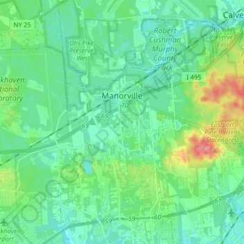
Name: Manorville topographic map, elevation, terrain.
Average elevation: 22 m
Minimum elevation: 4 m
Maximum elevation: 80 m
Other topographic maps
Click on a map to view its topography, its elevation and its terrain.



Cherry Grove
United States > New York > Suffolk County > Town of Brookhaven > Fire Island Pines
Average elevation: 0 m

Eastport South Manor Athletic Complex
United States > New York > Suffolk County > Town of Brookhaven > Eastport
Average elevation: 15 m