Geolocate

Haar topographic map

Click on the map to display elevation.

About this map

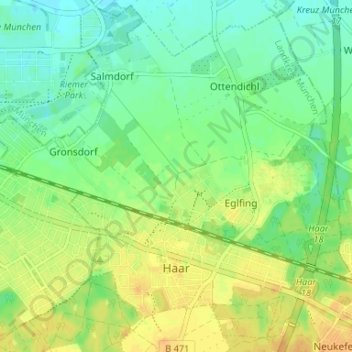
Name: Haar topographic map, elevation, terrain.

Location: Haar, Landkreis München, Bavaria, 85540, Germany (48.09748 11.69404 48.13785 11.75985)

Average elevation: 538 m

Minimum elevation: 525 m

Maximum elevation: 552 m

Gear up for your next adventure:

🧥Waterproof Hiking Jacket - Protect yourself from rain and wind while hiking
🔋Lithium AA Batteries - Long-lasting power that performs in extreme cold
🧤Insulated Winter Gloves - Heavy-duty protection for sub-zero Canadian adventures
🧢Outdoor Visor - Breathable visor for sunny hikes
🥾Waterproof Hiking Boots - Essential footwear for rugged terrain and wet Canadian trails

As an Amazon Associate, this site earns from qualifying purchases at no extra cost to you.