
Thank you for supporting this site ❤️
Make a donation
Make a donation
Gear up for your next adventure:
As an Amazon Associate, this site earns from qualifying purchases at no extra cost to you.
Bondsville topographic map
Click on the map to display elevation.
Thank you for supporting this site ❤️
Make a donation
Make a donation
Gear up for your next adventure:
As an Amazon Associate, this site earns from qualifying purchases at no extra cost to you.
About this map
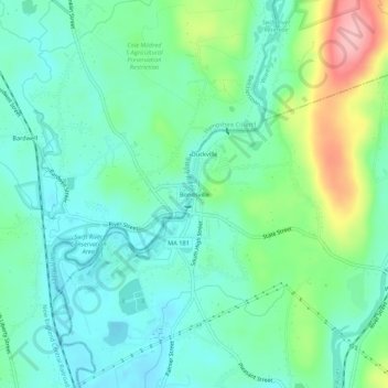
Name: Bondsville topographic map, elevation, terrain.
Average elevation: 130 m
Minimum elevation: 91 m
Maximum elevation: 236 m
Thank you for supporting this site ❤️
Make a donation
Make a donation
Gear up for your next adventure:
As an Amazon Associate, this site earns from qualifying purchases at no extra cost to you.
Other topographic maps
Click on a map to view its topography, its elevation and its terrain.
Three Rivers Well Field
United States > Massachusetts > Hampden County > Palmer > Four Corners
Average elevation: 110 m
Forest Lake
United States > Massachusetts > Hampden County > Palmer > Whipples
Average elevation: 149 m