
Glossop topographic map
Interactive map
Click on the map to display elevation.
About this map
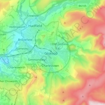
Name: Glossop topographic map, elevation, terrain.
Average elevation: 284 m
Minimum elevation: 103 m
Maximum elevation: 615 m
Other topographic maps
Click on a map to view its topography, its elevation and its terrain.
Buxton
Royaume-Uni > Angleterre > Derbyshire > High Peak
Buxton, High Peak, Derbyshire, Angleterre, Royaume-Uni
Average elevation: 334 m