
Harbury topographic map
Click on the map to display elevation.
About this map
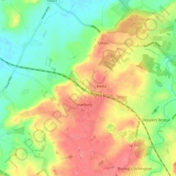
Name: Harbury topographic map, elevation, terrain.
Average elevation: 95 m
Minimum elevation: 62 m
Maximum elevation: 129 m
Other topographic maps
Click on a map to view its topography, its elevation and its terrain.
Burton Dassett Hills Country Park
United Kingdom > England > Warwickshire > Stratford-on-Avon > Northend > Burton Dassett CP
Average elevation: 132 m
Wellesbourne
United Kingdom > England > Warwickshire > Stratford-on-Avon > Wellesbourne
Average elevation: 69 m
Cranhill
United Kingdom > England > Warwickshire > Stratford-on-Avon > Ardens Grafton
Average elevation: 57 m