Geolocate

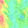
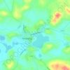
Knockacullion topographic map

Click on the map to display elevation.

About this map

Name: Knockacullion topographic map, elevation, terrain.

Location: Knockacullion, Sheskin Electoral Division, Monaghan Municipal District, County Monaghan, Ulster, Ireland (54.29990 -7.13158 54.30655 -7.12208)

Average elevation: 147 m

Minimum elevation: 96 m

Maximum elevation: 264 m

Other topographic maps

Click on a map to view its topography, its elevation and its terrain.

Lough Fea

Ireland > County Monaghan

Average elevation: 50 m

Lough Egish

Ireland > County Monaghan

Average elevation: 158 m

Magheracloone

Ireland > County Monaghan

Average elevation: 57 m

Annayalla

Ireland > County Monaghan

Average elevation: 123 m

Newbliss

Ireland > County Monaghan > Newbliss

Average elevation: 115 m

Ballybay Town Park

Ireland > County Monaghan

Average elevation: 94 m

Tydavnet

Ireland > County Monaghan

Average elevation: 88 m

Inniskeen

Ireland > County Monaghan

Average elevation: 60 m

Gear up for your next adventure:

🔦LED Headtorch - Bright and durable light for night activities
🧦Merino Wool Socks - Moisture-wicking comfort for long-distance hiking
💧Reusable Water Bottle - Durable water bottles for hydration on trails
🔭Compact Binoculars - Lightweight optics for scouting trails and wildlife
🧰Survival Kit - Essential gear for emergencies in the wilderness

As an Amazon Associate, this site earns from qualifying purchases at no extra cost to you.