
Agivey River topographic map
Interactive map
Click on the map to display elevation.
About this map
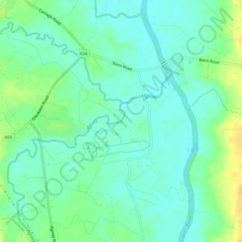
Name: Agivey River topographic map, elevation, terrain.
Average elevation: 9 m
Minimum elevation: 0 m
Maximum elevation: 26 m
Other topographic maps
Click on a map to view its topography, its elevation and its terrain.
Feigh Mountain
Reino Unido > Northern Ireland > Dunseverick
Feigh Mountain, Dunseverick, County Antrim, Northern Ireland, Reino Unido
Average elevation: 35 m
Seacash
Reino Unido > Northern Ireland > Aldergrove
Seacash, Aldergrove, County Antrim, Northern Ireland, Reino Unido
Average elevation: 73 m
Town Parks
Reino Unido > Northern Ireland > Larne
Town Parks, Larne, County Antrim, Northern Ireland, Reino Unido
Average elevation: 47 m
Lough Neagh
Reino Unido > Northern Ireland > Lisburn
Lough Neagh, Lisburn, County Antrim, Northern Ireland, Reino Unido
Average elevation: 29 m