Geolocate

Occobamba topographic map

Click on the map to display elevation.

About this map

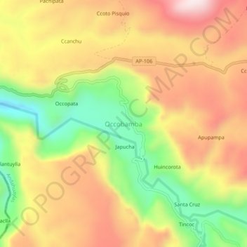
Name: Occobamba topographic map, elevation, terrain.

Location: Occobamba, Pampachiri, Andahuaylas, Apurímac, Perú (-14.25104 -73.51978 -14.21104 -73.47978)

Average elevation: 3,660 m

Minimum elevation: 3,390 m

Maximum elevation: 3,896 m

Gear up for your next adventure:

🛶Kayak Dry Bag - Waterproof storage for kayaking adventures
🧦Merino Wool Socks - Moisture-wicking comfort for long-distance hiking
🔨Vehicle Emergency Tool - Safety tool for remote road trips to trailheads
🦶Anti-Blister Balm - Prevents friction and hotspots during long ascents
🛶Kayak Accessories - Essential gear for safe and fun kayaking adventures

As an Amazon Associate, this site earns from qualifying purchases at no extra cost to you.