
Trsic topographic map
Interactive map
Click on the map to display elevation.
About this map
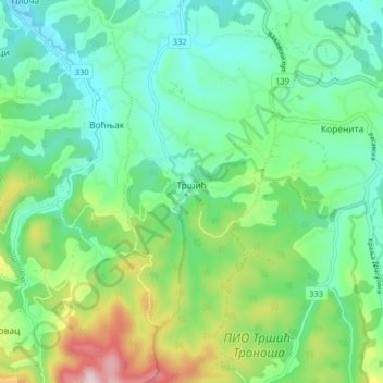
Name: Trsic topographic map, elevation, terrain.
Average elevation: 246 m
Minimum elevation: 135 m
Maximum elevation: 534 m
Other topographic maps
Click on a map to view its topography, its elevation and its terrain.
Тришићи
Serbia > Central Serbia > Macva Administrative District > Mali Zvornik Municipality
Тришићи, Radalj, Mali Zvornik Municipality, Macva Administrative District, Central Serbia, 15321, Serbia
Average elevation: 280 m
Šabac
Serbia > Central Serbia > Macva Administrative District
Šabac, City of Šabac, Macva Administrative District, Central Serbia, 15000, Serbia
Average elevation: 81 m