Geolocate

El Muedo topographic map

Click on the map to display elevation.

About this map

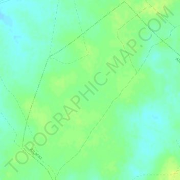
Name: El Muedo topographic map, elevation, terrain.

Location: El Muedo, Alcaraz, Castilla-La Mancha, España (38.87486 -2.63902 38.89486 -2.61902)

Average elevation: 975 m

Minimum elevation: 967 m

Maximum elevation: 983 m

Gear up for your next adventure:

🧥Fleece Jacket - Warm and lightweight jacket for layering
🧰Survival Kit - Essential gear for emergencies in the wilderness
💡Solar Camping Lamp - Eco-friendly lighting for campsites
🧤Rechargeable Heated Gloves - Extreme warmth for Canadian winter expeditions
🦯Trekking Poles - Reduced impact on joints for steep topographic climbs

As an Amazon Associate, this site earns from qualifying purchases at no extra cost to you.