
Eyvas topographic map
Interactive map
Click on the map to display elevation.
About this map
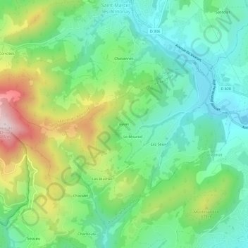
Name: Eyvas topographic map, elevation, terrain.
Average elevation: 564 m
Minimum elevation: 398 m
Maximum elevation: 907 m
Other topographic maps
Click on a map to view its topography, its elevation and its terrain.
Les Seux
France > Auvergne-Rhône-Alpes > Ardèche > Boulieu-lès-Annonay
Les Seux, Boulieu-lès-Annonay, Tournon-sur-Rhône, Ardèche, Auvergne-Rhône-Alpes, France métropolitaine, 07100, France
Average elevation: 532 m